
Raia Border Villages
Idanha-a-Velha (Idanha-a-Nova)
One of the oldest settlements in the group, its earliest foundations date back to the Roman Empire. It was renamed Egitânia during the Visigothic period and taken by the Arabs at the end of the 1st century. Afonso III of León reconquered it, making its territory part of the County of Portugal. Later, Afonso Henriques donated Idanha-a-Velha and Monsanto to Gualdim Pais, knight of the Order of the Templars. It received its first charter in 1229 during the reign of King Sancho II. It was a municipality from 1821 to 1836.
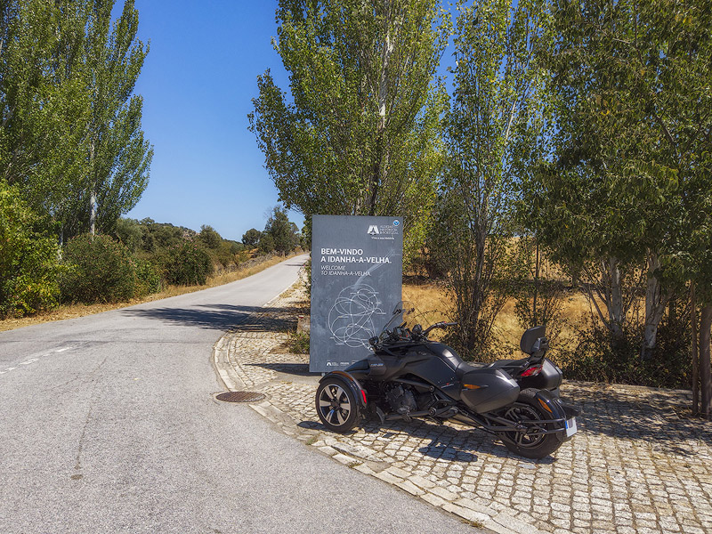
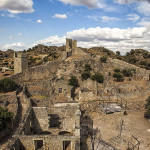
Idanha-a-Velha is located on a meander of the Ponsul river, which surrounds it on all sides except the North. Of its military legacy, only part of the oval-shaped wall and some ruins of the Keep Tower (Templar Tower) remain today.
Points of interest: Church of Santa Maria (Cathedral), Parish Church, Pillory, Epigraphic Archive, Olive Press (Tourism Office), North Gate, Walls and Keep Tower (Templar Tower), Roman Bridge over the Pônsul River, Casa Marrocos and Chapel of São Sebastião (exterior), among others.
Monsanto (Idanha-a-Nova)
Although it is believed that a prehistoric hillfort once existed nearby, the origins of the village of Monsanto date back to the reign of Afonso Henriques, when he defeated the Arabs and donated the settlement (1165) to Gualdim Pais. It was under this Templar knight that the castle was built, receiving its charter shortly after (1174). Monsanto remained a municipal seat until 1853.
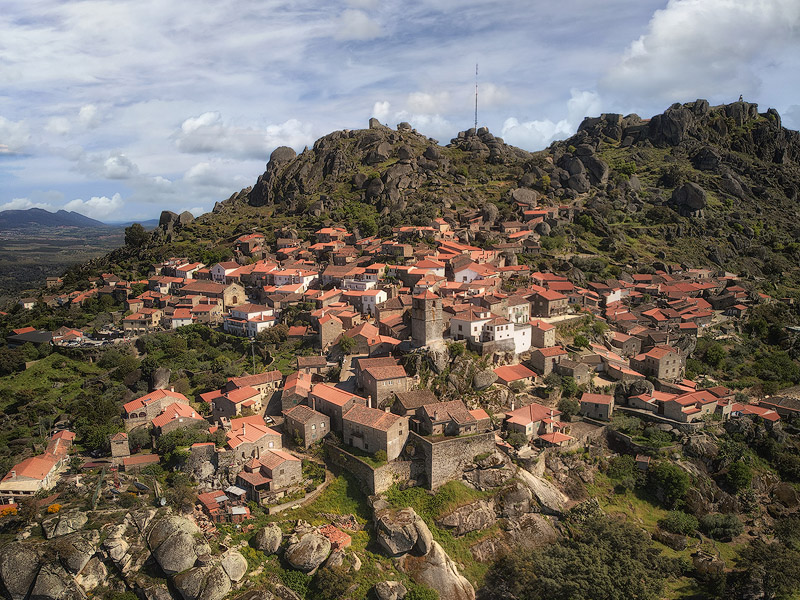
Located on the northern slope of Cabeço de Monsanto (derived from Mons Sanctus or Holy Hill), it holds the title of "The Most Portuguese Village in Portugal", awarded in 1938 in a competition promoted by the Estado Novo regime. It received a Silver Rooster, the competition’s prize, which could be displayed in the village until the next edition — which was supposed to take place two years later but never did. The first edition was the only one, and a replica of the Silver Rooster can still be seen today on the Clock Tower (or Lucano Tower).
There may be debate about the merit of its title, but there is no doubt about the beauty of the place and its narrow granite-lined streets, where the stone often forms both the walls and roofs of houses.
Points of interest: Cannon Square Viewpoint, Parish Church (Nossa Senhora da Azenha), Churches of São Salvador, Wayside Cross, Pillory, Lucano Tower, Santo António Gates, house where Fernando Namora lived, Fonte Nova Fountain, Community Oven, Monsanto Cave, São Sebastião Arch, Santo António Gates, Furdas, Barrocais Route, Penedo do Pé Calvo, Walls, Cistern, Keep Tower, Ruins of São Miguel Chapel, Laje das Treze Tigelas.
Sortelha (Sabugal)
One of the best-preserved medieval villages. It was granted a charter in 1228 by King Sancho II. The foundations of the castle and walls date from this period, although it is believed that a pre‑Roman hillfort once existed here. It was a town and municipal seat between 1288 and 1855.
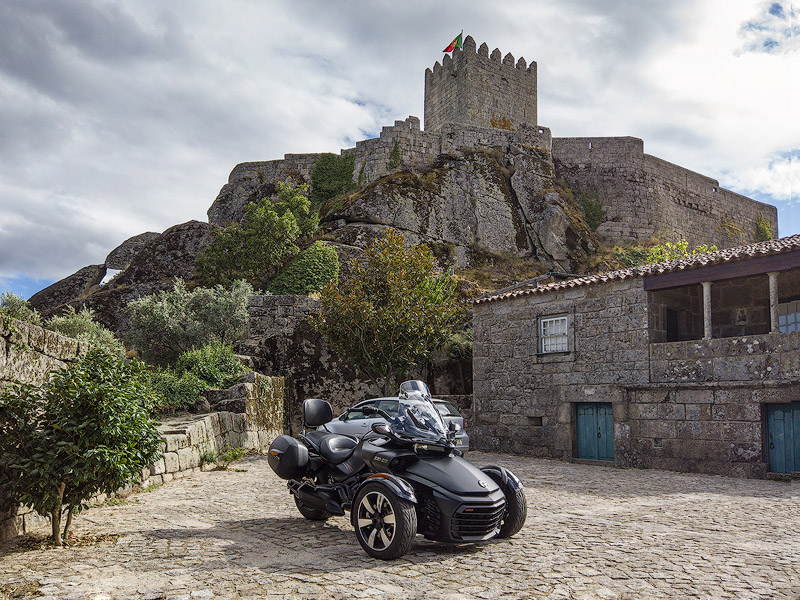
Sortelha is truly a granite village. The castle, walls, houses, and even the street pavements are all made from this stone. Its location on a hilltop was crucial to its development, as it allows long‑distance views over the surrounding fields.
Points of interest: Largo do Corro, Walls, Gates, Parish Church (Nossa Senhora das Neves), Castle and Keep Tower, Former Citadel (with Cistern), Manueline Pillory, Former Town Hall, Governor’s House, Arab House, Jardim do Anel, Cabeça da Velha rock formation, among others.
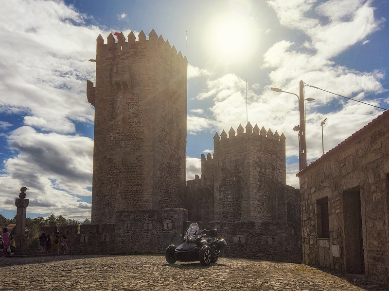
Sabugal
The earliest human presence here is attributed to an ancient prehistoric hillfort near the Côa river. The Romans also established a small military outpost to secure the river crossing.
Little is known about the Muslim presence, but in 1160 it is likely that Afonso Henriques took control of these lands, losing them shortly after to the Kingdom of León.
In 1296, King Dinis reconquered the area and ordered the construction of several castles in the region, including Sabugal, known as the Castle of the Five Corners due to its elevated pentagonal Keep Tower. It was also at this time that it received its charter, and its definitive possession was secured by the Treaty of Alcañices (1297).
Tradition says that the famous Miracle of the Roses involving Queen Saint Isabel and King Dinis took place in the castle square.
Sabugal is the seat of the municipality and incorporated the municipalities of Alfaiates and Vila do Touro in 1836, and Sortelha and Vilar Maior in 1855. Today, the municipality lies within the Serra da Malcata, with the city bordered to the West by the Côa river, which continues southward after passing the Sabugal dam.
Points of interest: Castle, Bell Tower and Town Gate, Sabugal Museum, Pillory, Devesa River Beach (Côa River), Historic Centre, Town Hall, Parish Church (São João), Church of the Misericórdia (which contains the medieval measuring stone known as the Côvado or Alna — a textile linear measure equivalent to 26in66cm, or 3 handspans).
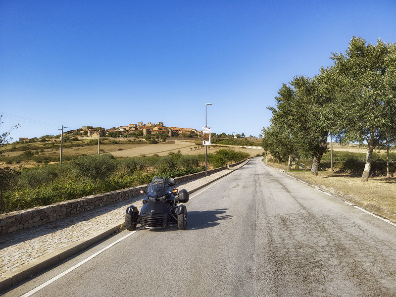
Castelo Mendo (Almeida)
Located about 6mi10km from the border, the village of Castelo Mendo sits atop a granite outcrop and is entirely enclosed within its walls.
As with other settlements, it is believed that human occupation predates the Roman period. The first construction of the castle likely occurred only at the end of the 12th century during the reign of King Sancho I. It received its charter in 1229, when the first official Feira Franca (Free Fair) of the kingdom was also established, lasting eight days during Easter, the feast of Saint John, and the feast of Saint Michael. At the time, its mayor, appointed by King Dinis, was Mendo Mendes, from whom the village likely takes its name.
It was definitively integrated into Portuguese territory by the **Treaty of Alcañices in 1297. The first records of abandonment appear in 1509, worsening when it ceased to be a municipal seat in 1855. Today it is well preserved and has around one hundred inhabitants.
Points of interest: Town Gate, Mendo and Menda statues, Church of São Pedro, Pillory, Town Hall (Tourism Office, Museum of the Senses), Ruins of the Church of Santa Maria do Castelo, Castelinho Gate, Nobleman’s Tomb (funerary stone of Miguel Augusto de Sousa Mendonça Corte Real).
Almeida
It was taken from the Moors during the reign of King Sancho II by Paio Guterres, grandson of Egas Moniz, who renamed it Almeida. It survived successive wars and invasions, being definitively recovered from the French in 1811.
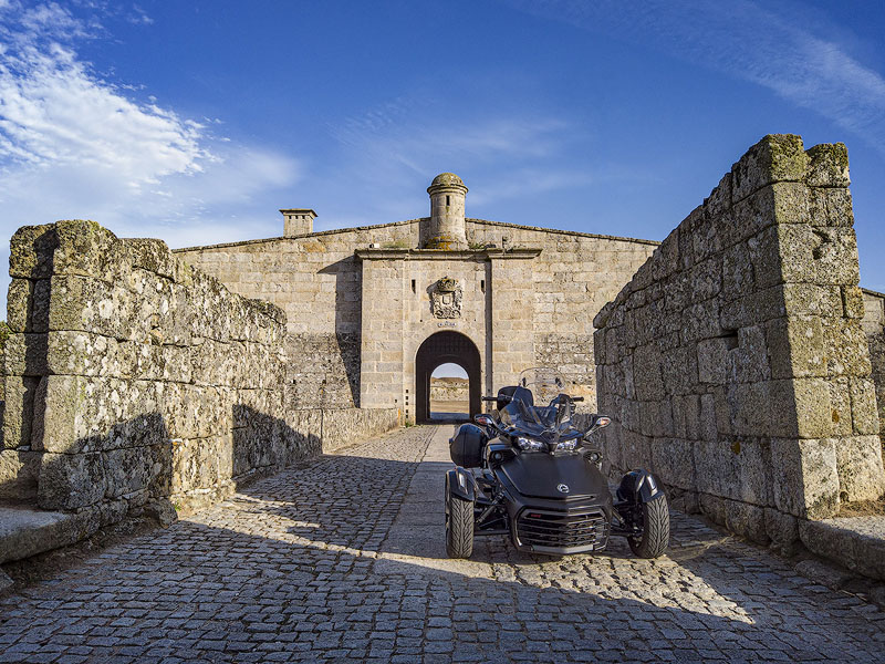
Considered the most monumental fortress in the country, its star-shaped stronghold (with six bastions and a perimeter of 8,202ft2,500m was built during the Restoration of Independence, with construction completed at the end of the 18th century under the orders of the Count of Lippe. It suffered major damage when it was taken by the French, who detonated the powder magazine under artillery fire. It was again a battleground during the Liberal Wars between 1832 and 1834.
In 1927, the last cavalry squadron left, and Almeida permanently lost its military function. It has been a municipal seat since 1926.
Points of interest: Walls, Barracks, Ruins of the Old Castle, Clock Tower, Pousada, Casa da Roda, Town Hall, former Artillery Barracks, Military Museum.
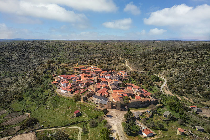
Castelo Rodrigo (Figueira de Castelo Rodrigo)
This is a very ancient place where human presence is believed to date back to prehistory. It was inhabited by Turduli, Romans, and Moors before becoming part of the Kingdom of León (11th century) and later Portuguese territory (Treaty of Alcañices, 1297). It was at this time that King Dinis ordered the reconstruction of Castelo Rodrigo and the reinforcement of its walls.
It was depopulated during the Wars of Independence, and the castle was rebuilt in 1508 by order of King Manuel I. The castle served as the official residence of the nobleman Cristóvão de Moura between the 16th and 17th centuries. His support for John I of Castile during the dynastic crisis led to a popular uprising that burned the palace, leaving the ruins seen today.
Castelo Rodrigo stands atop a hill dominated by white and pink quartzite. The village still preserves its medieval circular layout with surrounding walls, believed to have been originally built by the Romans. It faces the remarkable Serra da Marofa, whose highest point reaches about 3,205ft977m.
It became a municipality in the 16th century but gradually lost prominence to the settlement of Figueira below. In 1836 it lost its municipal seat to Figueira, which then became Figueira de Castelo Rodrigo.
Points of interest: Castle Ruins, Ruins of the Palace of Cristóvão de Moura, Manueline Pillory, Cistern, Parish Church (Nossa Senhora de Rocamador), Porta do Sol, Clock Tower, Restoration Monument, Serra da Marofa, among others.
Pinhel
The city of Pinhel is located on the slopes of the Côa river, forming part of the Ribacôa region along with other municipal seats such as Sabugal and Mêda. It is surrounded by hills, plateaus, and mountains, and lies not far from the Serra da Marofa.
It is believed that the Turduli settled in these lands around 500 BC. However, Pinhel only received its charter in 1209 from King Sancho I. During the reign of King Dinis, the castle was rebuilt and the wall surrounding the town (today’s historic centre) was constructed. It is known as the "Falcon City", a symbol also represented on its coat of arms.
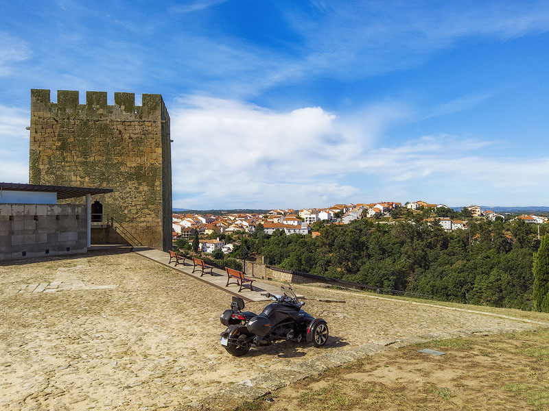
Legend says that the Pinhel detachment captured the King of Castile’s favourite falcon during the Battle of Aljubarrota, and from that moment the Master of Avis began referring to the place as Pinhel Falcão. In truth, the Falcon of Pinhel represents the loyalty and bravery of the people of Pinhel, who remained patriotically aligned with the Master of Avis during Castilian attacks.
Points of interest: Castle, Castle Gates, Walls, Wall Walkway, Pillory, Clock Tower, Barbican, Solar Falcão (Town Hall), Cultural Centre, among others.
Messages:
Posted on 2025-01-17 by Jack pereira
Posted on 2025-01-20 by Daniel Santos
Leave a message